Project Duration – March 2021- Ongoing
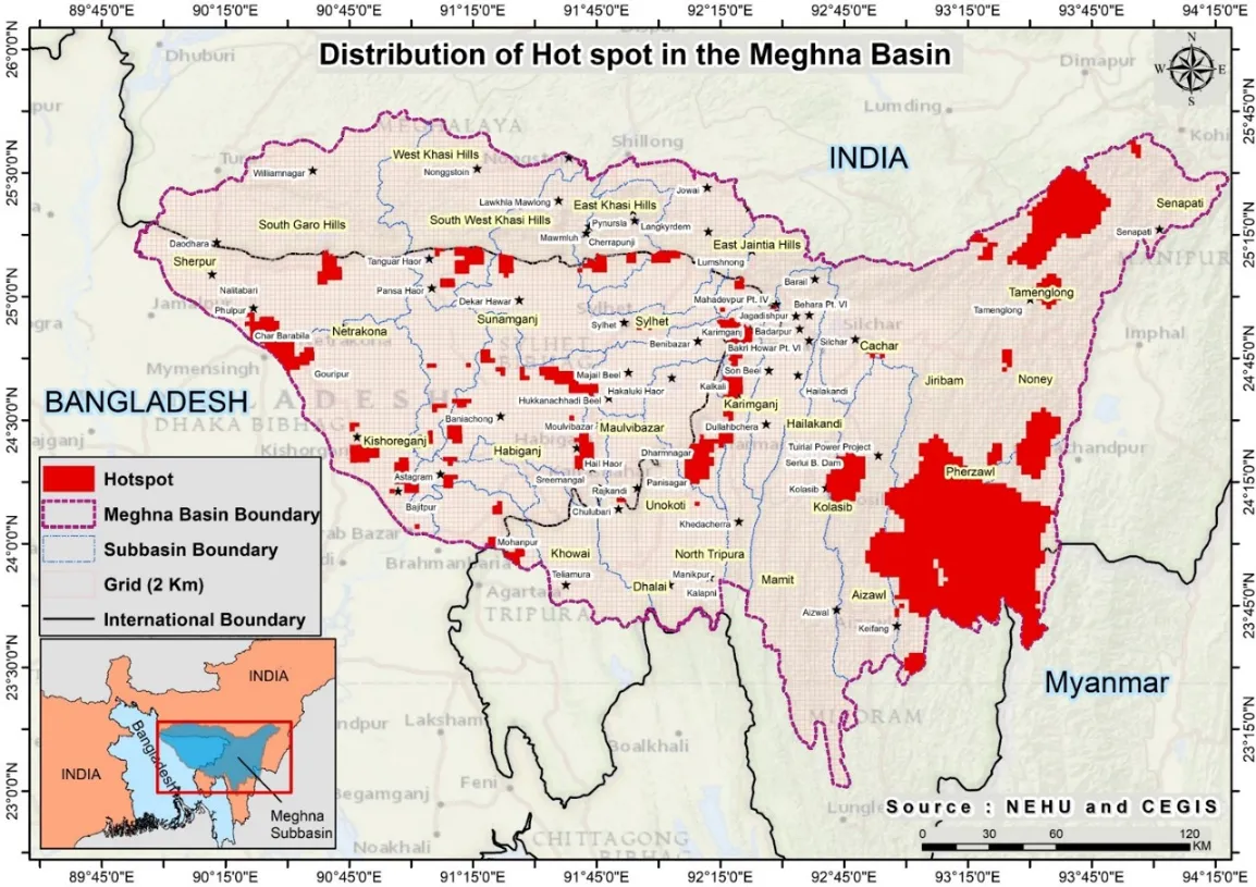
IORA is developing an atlas with illustrative thematic maps and is also generating the sub-basin land use maps (in consultation with IUCN, North Eastern Hill University (NEHU), Shillong and the Center for Environmental and Geographic Information Services (CEGIS)) for all 29 transboundary tributaries of Meghna River, indicating hotspots of changes in the river basin in the last 15 years.
The atlas will provide well-synthesised information to stakeholders and thereby promote evidence-based decision-making by policy makers, planners, private sector and civil society stakeholders, towards the development of Meghna basin.